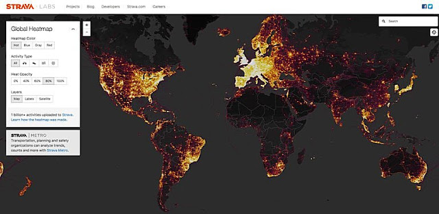
Strava fitness app can reveal military sites, analysts say. Source: NYT
A fitness app that posts a map of its users’ activity has unwittingly revealed the locations and habits of military bases and personnel, including those of American forces in Iraq and Syria, security analysts say. The app, Strava, which calls itself “the social network for athletes,” allows millions of users to time and map their workouts and to post them online for friends to see, and it can track their movements at other times. The app is especially popular with young people who are serious about fitness, which describes many service members. Since November, the company has published a global “heat map” showing the movements of people who have made their posts public. In the last few days, after the app’s oversharing was identified on Twitter by a 20-year-old Australian university student, security analysts have started to take note of that data, and some have argued that the map represents a security breach. Strava “is sitting on a ton of data that most intelligence entities would literally kill to acquire,” Dr. Jeffrey Lewis of the Middlebury Institute of International Studies at Monterey, Calif., warned on Twitter. Some analysts have taken to social media to warn that, although the map does not name the people who traced its squiggles and lines, individual users can easily be tracked, by cross-referencing their Strava data with other social media use. That could put individual members of the military at risk, even when they are not in war zones. The outlines of known military bases around the world are clearly visible on the map, especially in countries like Afghanistan, Iraq and Syria, where few locals own exercise tracking devices. In those places, the heat signatures on American bases are set against vast dark spaces. Tobias Schneider, a security analyst, wrote on Twitter that “known Coalition (i.e. US) bases light up the night.”


Comments